| Land: | Frankreich | |
| Administrative Region: | Centre-Val de Loire | |
| Départment: | Loir-et-Cher | |
| Arrondissement: | Vendôme | |
| Ort: | 41800 Lavardin | |
| Geographische Lage: | 47.740808°, 0.883269° | |
| Google Maps OpenStreetMap OpenTopoMap Burgenatlas | ||
| Archiv «Alle Burgen» |
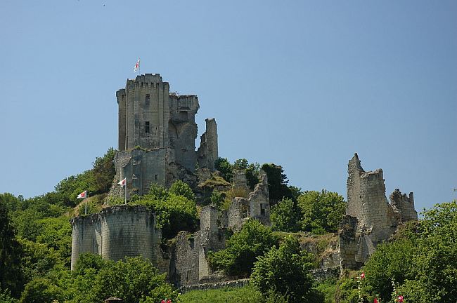
 Bild: By GIRAUD Patrick [GFDL, CC-BY-SA-3.0 or CC BY 2.5 ],
Land: Frankreich Administrative Region: Centre-Val de Loire Départment: Loir-et-Cher Arrondissement: Vendôme Ort: 41800 Lavardin Geographische Lage: 47.740808°, 0.883269° Google Maps OpenStreetMap OpenTopoMap Burgenatlas
Archiv «Alle Burgen»